Program Overview
The Interagency Ecological Program's (IEP) has monitored dissolved oxygen in the Stockton Deep Water Ship Channel since 1968. Water quality parameters are collected in the region between Prisoner's Point to Turning Basin during summer and fall when low DO conditions might occur. The objectives of this study are to 1) document long term trends and 2) determine if dissolved oxygen levels meet the water quality objectives set from the State Water Resources Control Board.
History
- 1968: IEP began monitoring within Stockton Deep Water Ship Channel
- 1997: 14 stations monitored consistently during summer and fall between Prisoner's Point and Turning Basin
- 2019: Triggered monitoring initiated
Methods
EMP initiates a discrete monitoring run when the daily average dissolved oxygen (DO) values at the Rough and Ready Island (RRI) station remain below Summer Limit or Fall Limit for three days in a row. RRI is a continuous water quality station where DO values are measured using s YSI EXO2 multi-parameter water quality instrument at three depths: 1 meter, 3 meters, and 6 meters below water surface.
Discrete monitoring for the DO study occurs when daily averages from any depth at the RRI station fall below the summer limit (5.5 mg/L) and fall limit (6.5 mg/L). Summer is defined as months June through August and Fall as September through November. The discrete monitoring occurs in the upper Stockton Deep Water Ship Channel at stations 10-14 shown in the map. DO levels are measured at each station at three distinct depths (1m, 3m, and 6m) below the water surface. Historically, 1997-2018, the EMP measured DO levels with a YSI 6600 instrument at 14 stations along the San Joaquin River and Stockton Deep Water Ship Channel every 2 weeks June 1 through November 30.
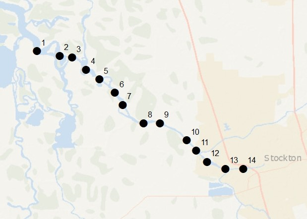
Map of the historical Discrete Water Quality Stations for the DO Study. DWR image. (click to enlarge in new window)
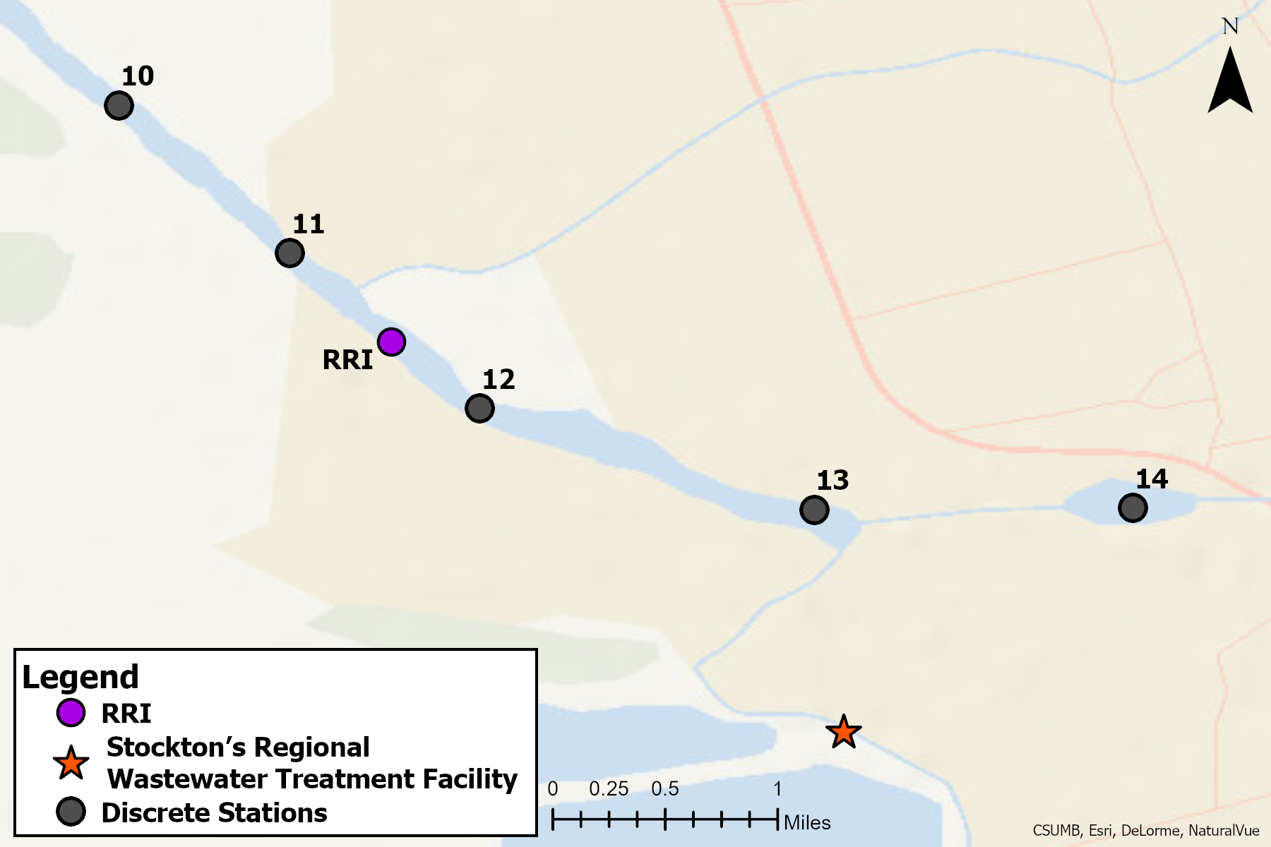
Map of the current Discrete Water Quality Stations for the DO Study. DWR image.